


Australia’s first large-scale coastal estuary study ranks Middle Harbour Creek as the tenth most microplastic-contaminated waterway in New South Wales, as it drains through the catchments of Seaforth, Davidson, Killarney Heights and Frenchs Forest before flowing into Middle Harbour.
The finding comes from the Broadscale Microplastic Assessment of NSW Estuaries, a four-year study covering 120 coastal waterways from 2021 to 2024. For Seaforth residents who walk the bush tracks above the creek, kayak its tidal stretches or simply know it as the waterway that defines the suburb’s southern boundary, the Grade E result, the highest contamination category in the study, is a number worth sitting with.


What Grade E Actually Means
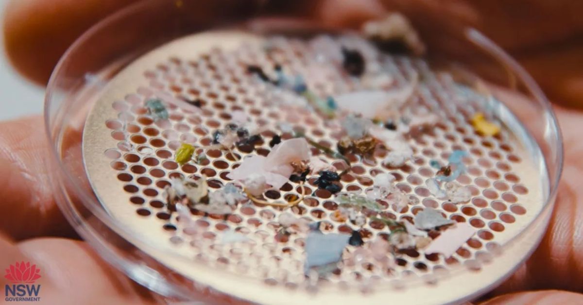
The study graded waterways on a five-point scale from Grade A, very low, to Grade E, very high. The very high threshold was set at concentrations above 1.3 microplastic particles per cubic metre, equivalent to an Olympic swimming pool containing 3,250 microplastic particles.
Middle Harbour Creek’s Grade E result places it alongside the Cooks River, Dee Why Lagoon, Manly Lagoon, Muddy Creek, and Toongabbie Creek, as some of the most microplastic-saturated waterways in the state. These are not obscure drainage channels; they are the waterways that define the geography and identity of Sydney’s most heavily urbanised suburbs. Middle Harbour Creek’s presence in that company reflects how thoroughly suburban development has shaped its catchment over the past 60 years.
The study found a strong relationship between urbanisation and microplastic contamination, with concentrations increasing by approximately one additional microplastic particle per cubic metre for every ten per cent increase in catchment urbanisation. Seaforth itself sits on a peninsula almost entirely surrounded by water, with stormwater from its roads, gardens and hard surfaces draining directly and rapidly into Middle Harbour Creek and Middle Harbour proper. There is very little buffer between what goes onto a Seaforth street or driveway and what ends up in the creek below.
Where the Plastic Actually Comes From
Across all samples statewide, foam, artificial turf fragments and plastic pellets accounted for 44 per cent of all microplastic items categorised and are identified as the highest priority sources for management intervention. Fragments and film from the breakdown of larger plastic items made up the remaining 56 per cent, with small particles between 0.25 and one millimetre dominating at 68 per cent of all particles counted.
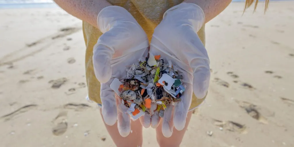
Synthetic sports surfaces are a significant contributor in catchments like Seaforth’s, where council playing fields and school ovals with artificial turf shed microplastic infill particles with every rain event. Those particles travel through gutters and stormwater pipes directly into the creek system. Everyday plastic waste, broken down by UV and abrasion into fragments too small to see, makes up the bulk of the remainder.
The study found that estuary hydrodynamics play a meaningful role in microplastic retention, with smaller, enclosed creek and lagoon systems consistently recording higher contamination than larger rivers in comparable catchments. Middle Harbour Creek does not function as a flushing river; it acts as a relatively contained tidal system that retains what enters it rather than dispersing it offshore. That characteristic makes it particularly vulnerable to accumulation over time.
The Broader Pattern Along This Stretch of Sydney
Middle Harbour Creek does not sit in isolation. Dee Why Lagoon ranked second most contaminated in all of NSW, with a microplastics count seven times greater than the Grade E threshold. Manly Lagoon ranked eighth statewide, and Narrabeen Lagoon, while outside the top ten, came in at 25th most contaminated with a Grade D rating. Three of NSW’s ten most polluted waterways sit within the Northern Beaches local government area, a concentration that points directly to the peninsula’s combination of dense urban catchments and enclosed coastal water bodies.
In contrast, Broken Bay, which forms the northern boundary of the Northern Beaches, ranked 100th out of 120 waterways statewide with a low contamination grade, demonstrating that geography and catchment character matter enormously. The difference between Broken Bay and Middle Harbour Creek is the difference between a large, open, minimally disturbed estuary and a smaller system draining one of Sydney’s most continuously developed suburban catchments.
Implications for Middle Harbour Creek
Seaforth is a suburb that takes its relationship with the natural environment seriously. Residents walk the bush reserves along the creek corridor through Garigal National Park daily, and they swim, paddle and sail in Middle Harbour throughout the year. The idea that microplastics are accumulating in the water below the suburb’s lookouts and along its foreshore paths is not an abstract environmental statistic; it is a local reality with consequences for the wildlife, the water quality and the people who use it.
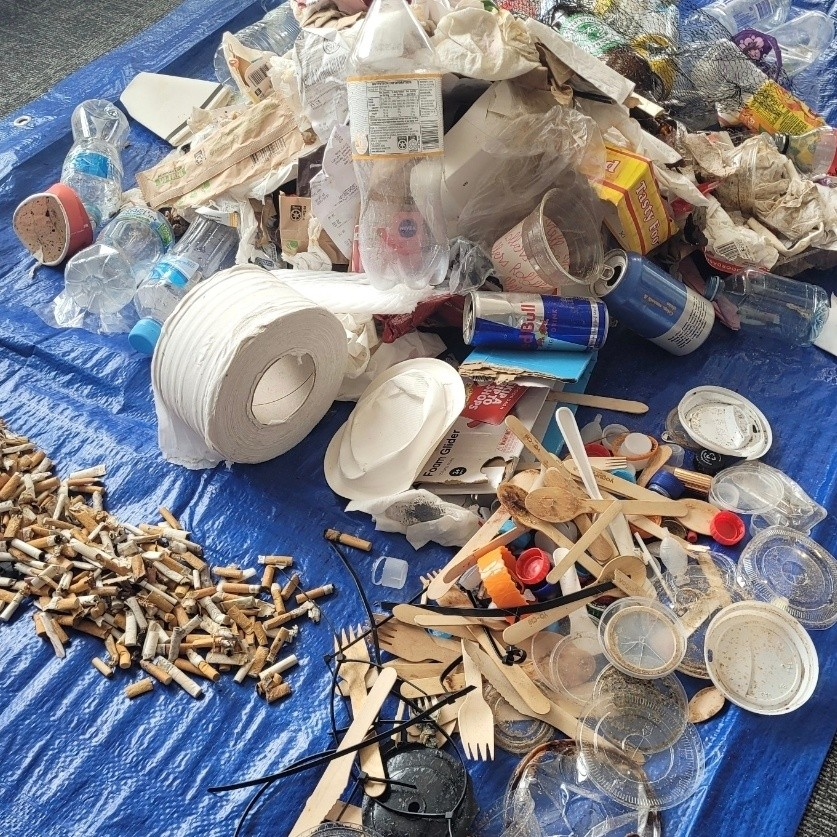
The study’s recommendations prioritise urban catchment intervention as the most effective management response, focusing on stormwater treatment improvements, containment and phase-out of artificial turf infill and enforcement of plastic pellet handling requirements for industrial users. For individual residents, the most direct contributions are the unglamorous ones: making sure bin lids stay closed before a rain event, sweeping hard surfaces rather than hosing them into gutters, avoiding single-use plastics that fragment easily, and considering natural grass alternatives when replacing artificial turf.
Community clean-up programs that intercept litter before it reaches the stormwater system also make a measurable difference. Every piece of plastic removed from a Seaforth street, footpath or park before a storm is one less piece making its way into the creek.
The full Broadscale Microplastic Assessment of NSW Estuaries report card is available here. Residents wishing to participate in local waterway monitoring and clean-up programs can contact AUSMAP at ausmap.org and Surfrider Foundation Australia at surfrider.org.au.
Published 27-March-2026